What makes Tihany an excellent place for excursions? Maybe the fact that everywhere we go, we’ll stumble upon historical sights, or infrequent post-volcanic rocks, or rare bird species. We went to tour the peninsula last fall, and we found the truly beautiful evidence of volcanic activity, we saw the new lookout tower from afar, and ran into a hiker from York while he was barbecuing chicken wings in the middle of nowhere.
Tihany Peninsula is a treasure. No wonder the first landscape park of Hungary, one rich in marsh and aquatic habitats, was created here in 1952. The post-volcanic activities made the area very special, and so it received the European Diploma of Protected Areas in 2003, which is the most prestigious European award for protected areas.
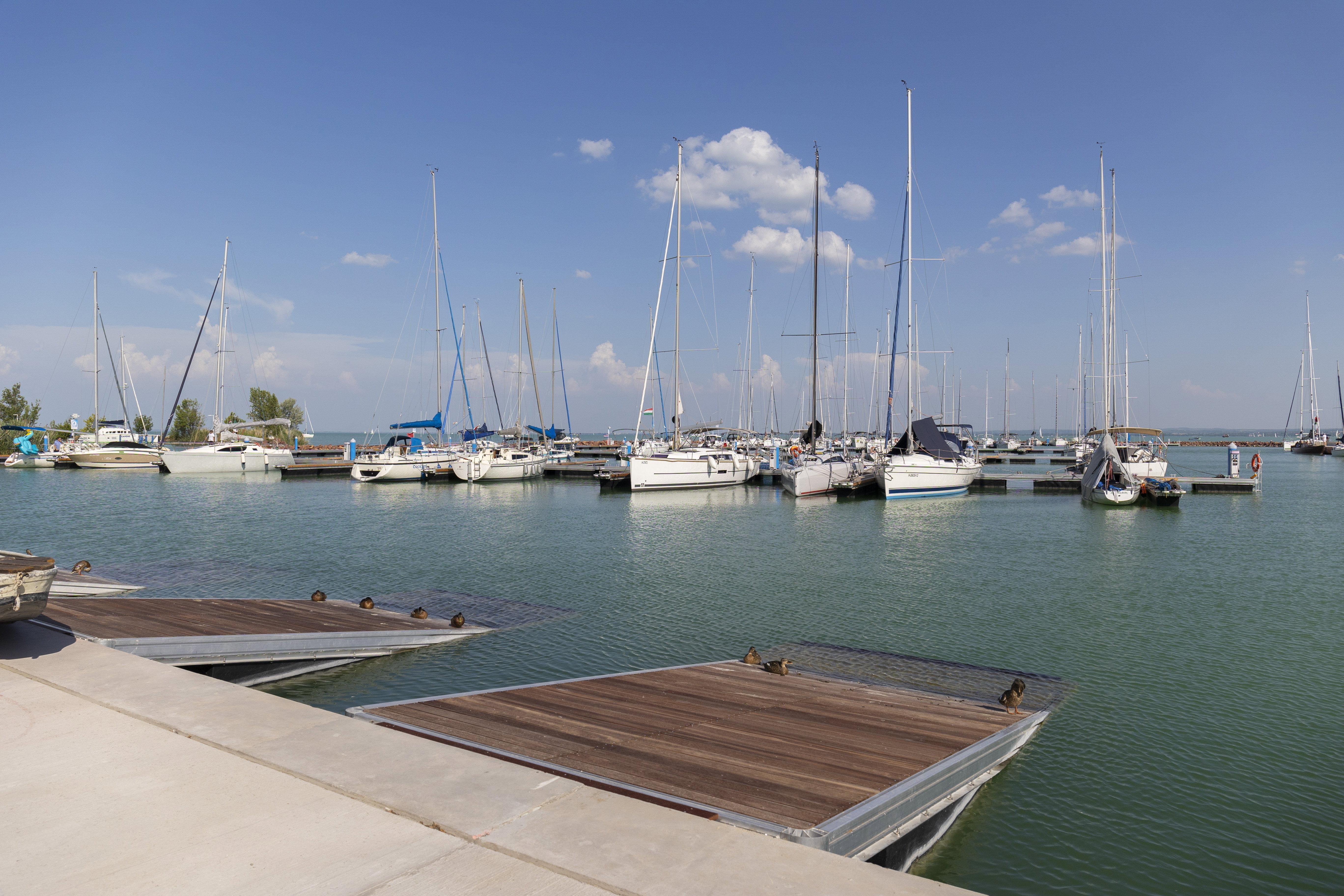
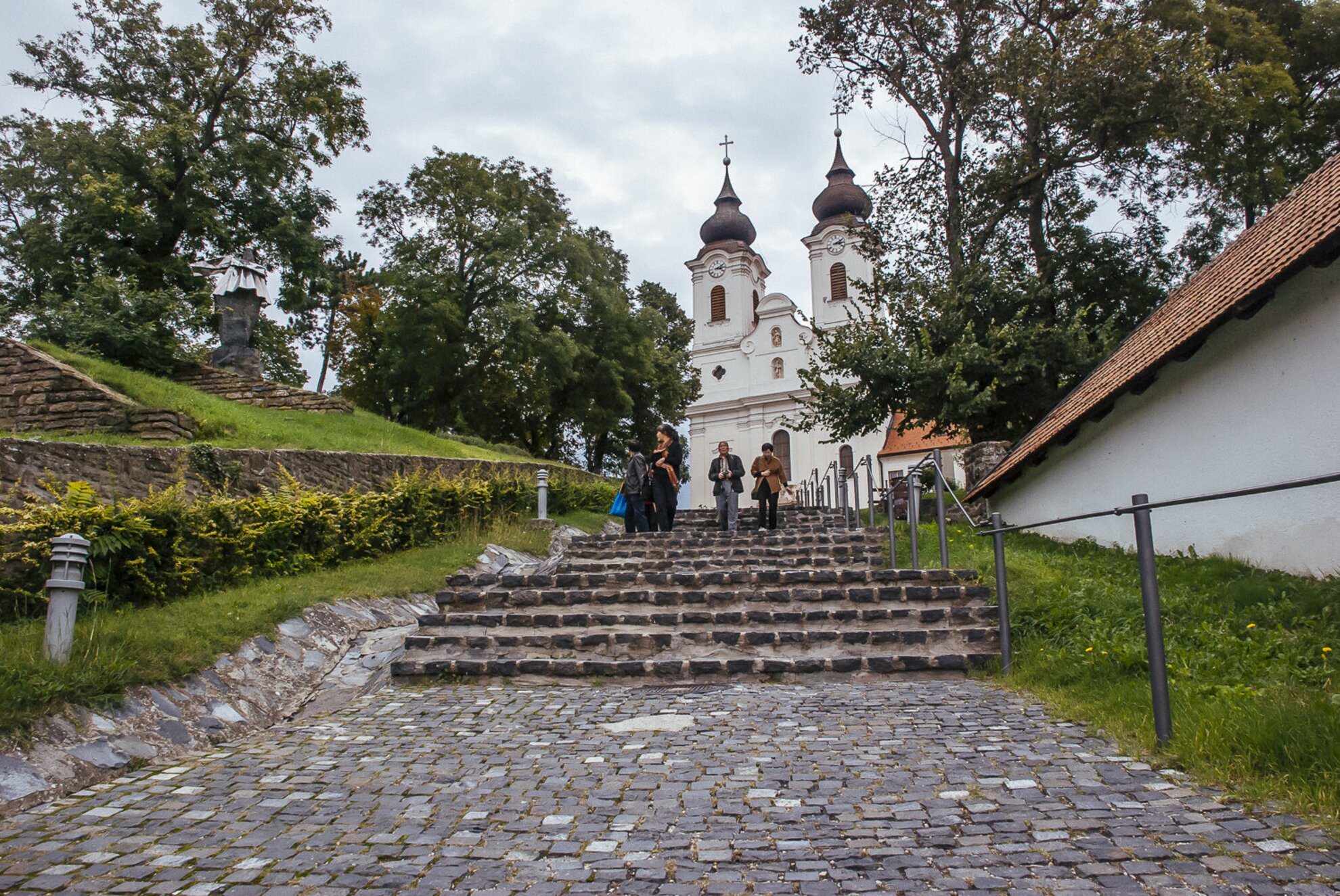
One day is enough to explore it, but Tihany is like a good book: it’s worth to revisit it from time to time, because we always find something new here. From ferry rides to visiting Piac Marketplace, from the Barátlakások to the local Kogart exhibits, there’re plenty of programs here to choose from if we want to spend an eventful Saturday in the area, but this time we went on a hike. It was filled with yellowing leaves, more and more of them falling, and with the inimitable fall light, just the way it should be. Our tour started from the Benedictine Abbey that was founded by Andrew I in 1055. The establishing charter of the abbey is a frequent topic in every Hungarian literature classroom, as it has the oldest written words of this language.
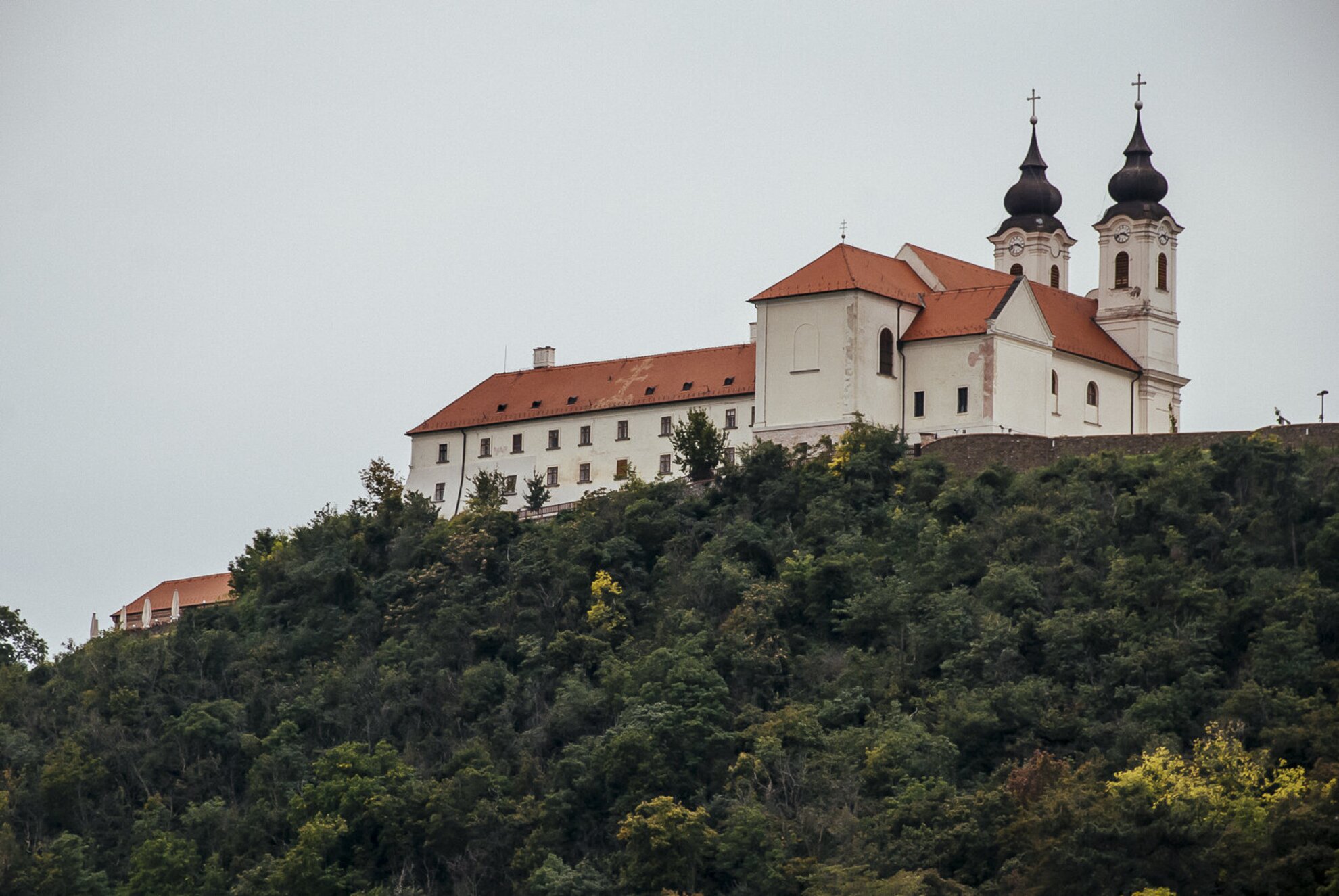
The original building of the abbey survived the Mongol invasion, then, as a fort and border fortress, it also weathered the Turkish times, which was a rare thing in Hungary during those times. What the armies couldn’t manage, a fire did: in 1683 the monastery buildings burned down. They started to rebuild them in 1719, and today’s Baroque two-tower church was finished in 1754 along with the new monastery buildings.
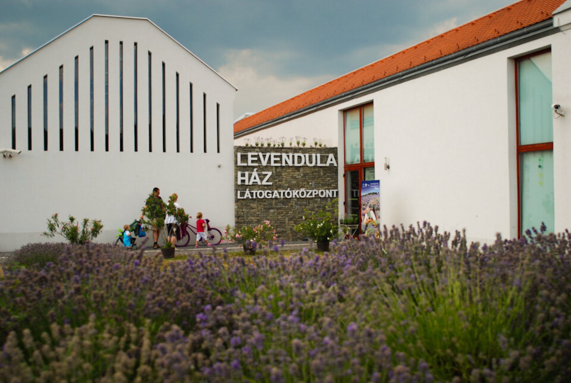
After the brief history class we walked down the main street of the village (following the yellow tour sign) to the Levendula Ház Visitor Center right on the shore of Lake Belső; here we can learn a lot about the origin of the peninsula, the centuries of co-existence between nature and the people of Tihany, and also about how lavender got acclimated here, which also led to the fact that nowadays they try to sell us purple syrups and lavender flavored honey at every corner in the center of Tihany.
There’s a semicircular study trail made of wooden planks that leads us into Lake Belső, while boards tell us all about the animals living here, like otters, ermines, kingfishers, or black-crowned night herons.
There are grass carps, Prussian carps, common carps, zanders, rudds, and catfish in the lake.
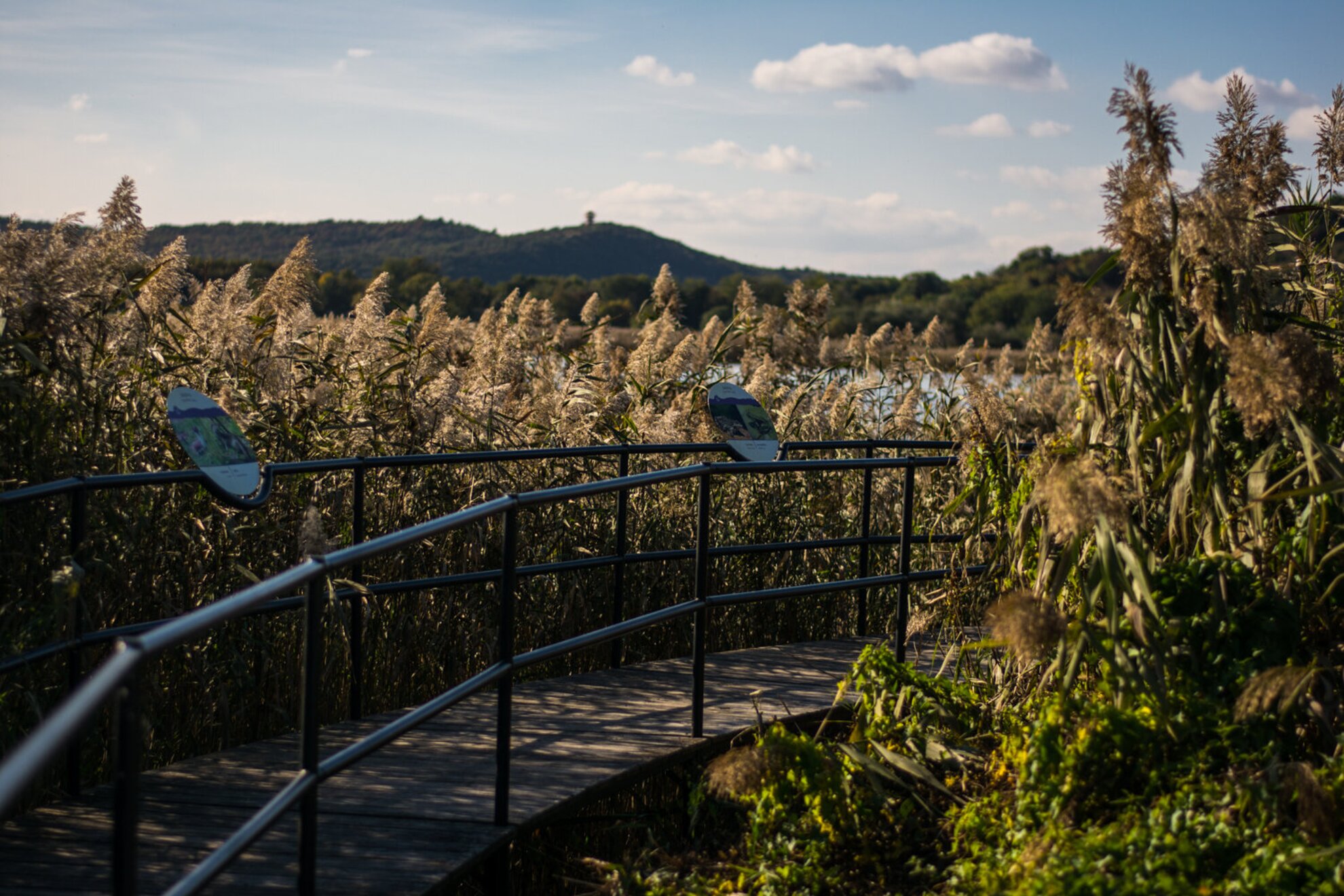
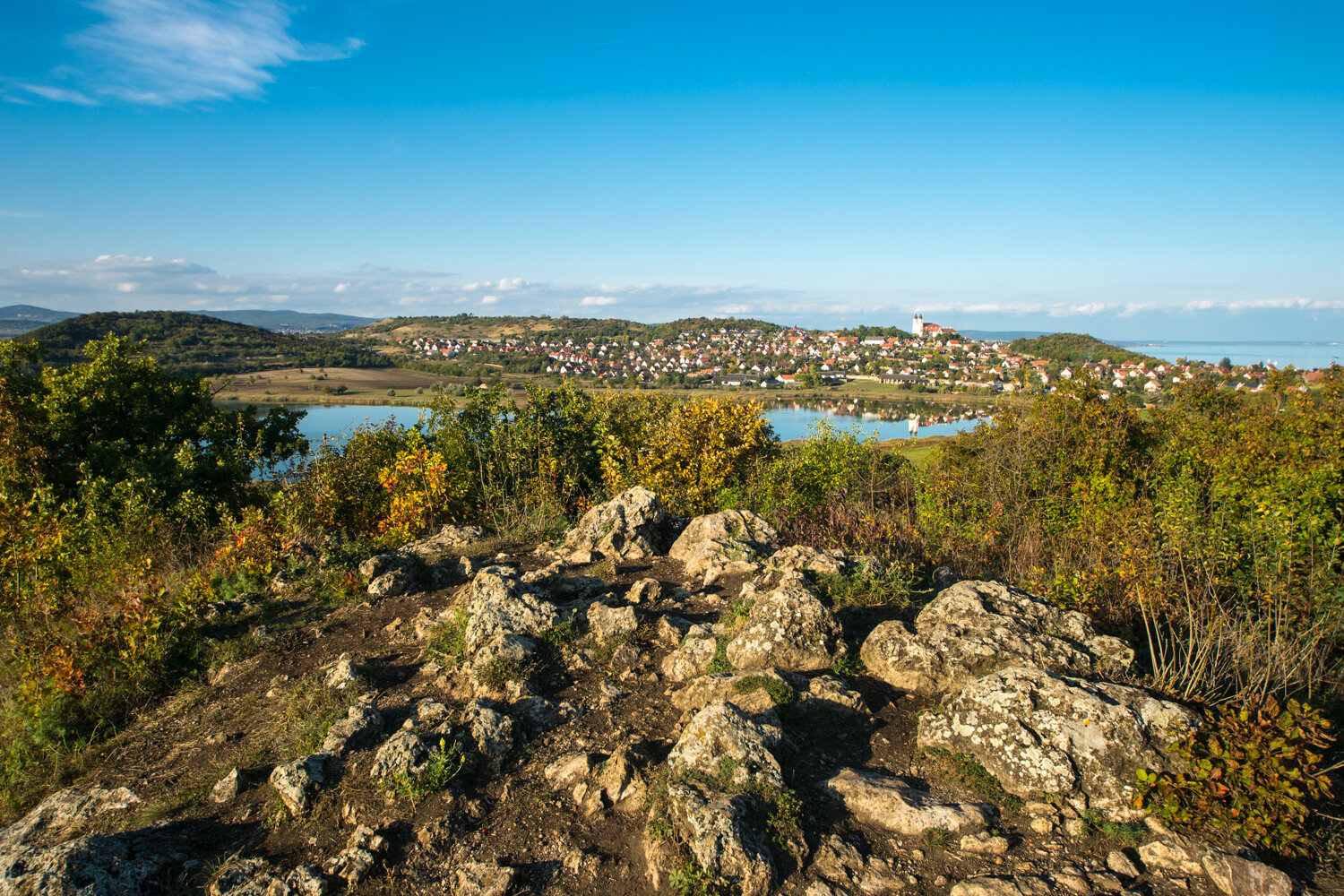
We can spot the new lookout tower in the background even from here, the one that was handed over to the public last fall.
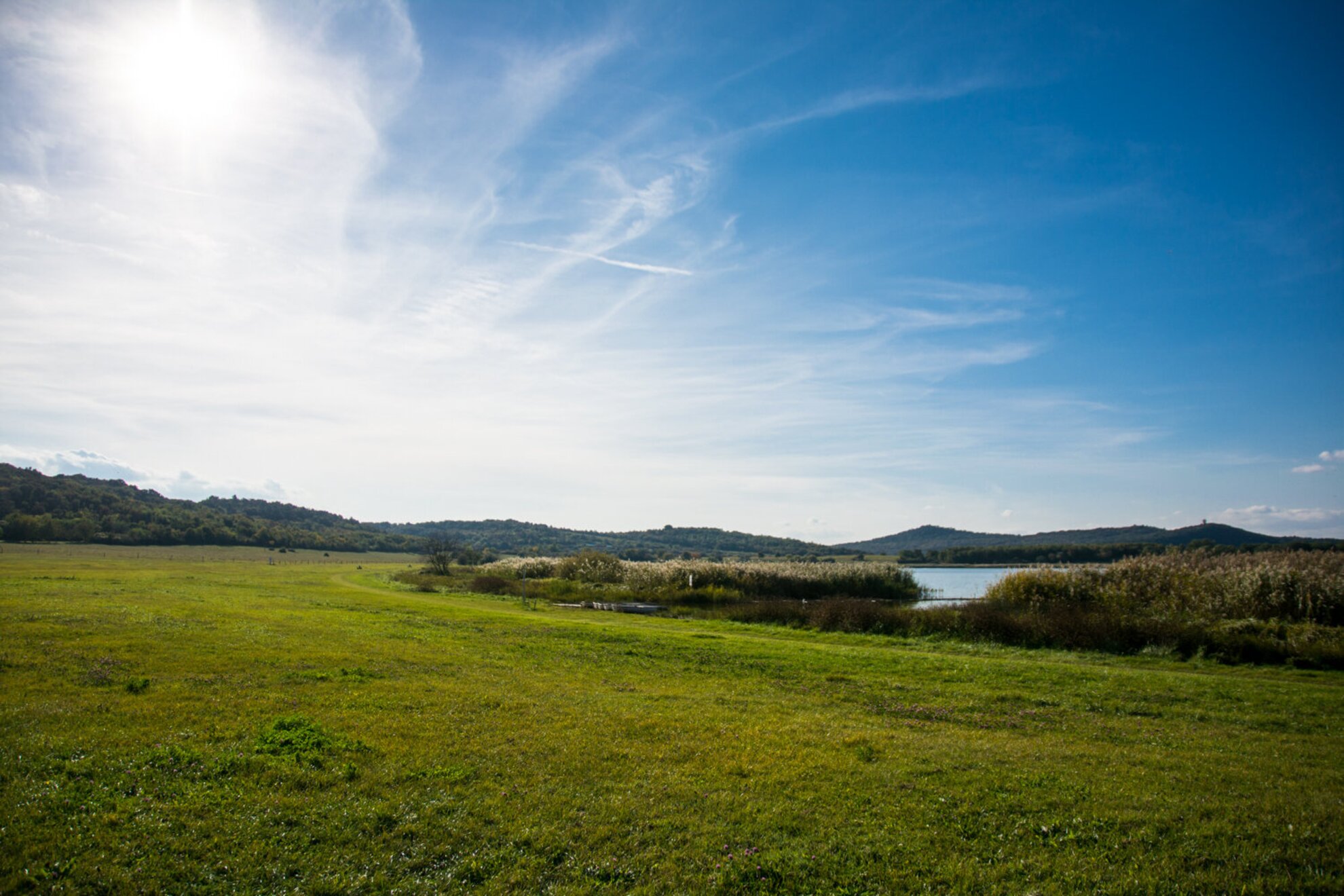
We keep walking on the shore of Lake Belső, until we reach the western edge of it.
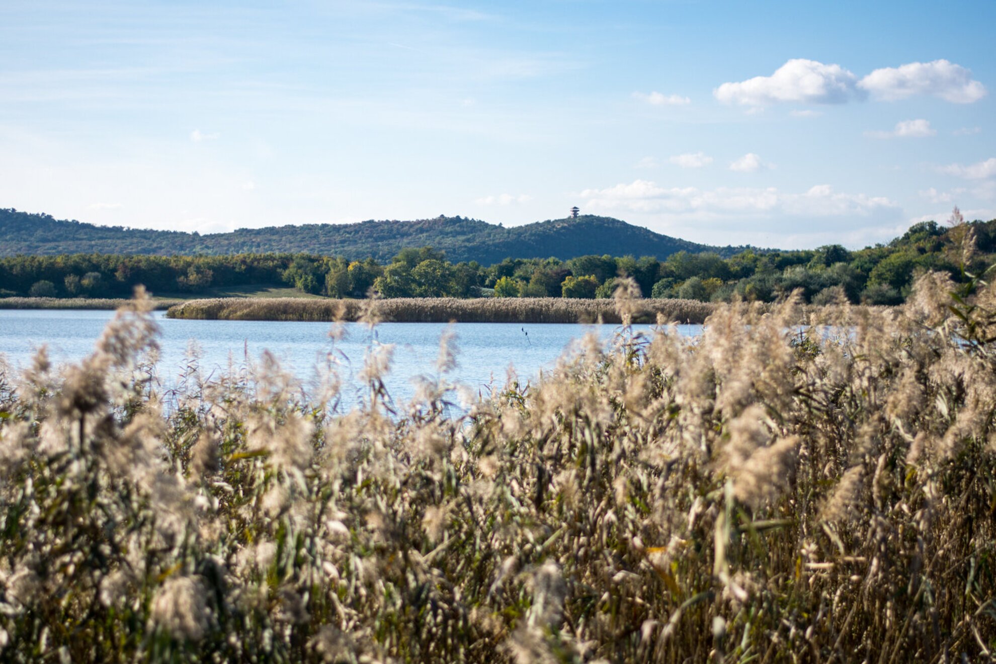
Looking back towards the abbey, we are greeted by a picture that is shown on every other postcard about Tihany – well, except for the flying dog that you can spot at the bottom right corner of the photo.

The lake used to be known for its rich flora and fauna, but in the past decades Asian herbivorous fish species have been planted in it, which lead to the total extinction of the original flora. This is why the birds that used to nest here migrated to Lake Külső, but there’re still a few nice specimens here.

The road from here goes along an electric fence (following the green “T” sign), up the hill to Aranyház geyser cone, which is one of the most beautiful spots of the study trail named after geologist Lajos Lóczy.
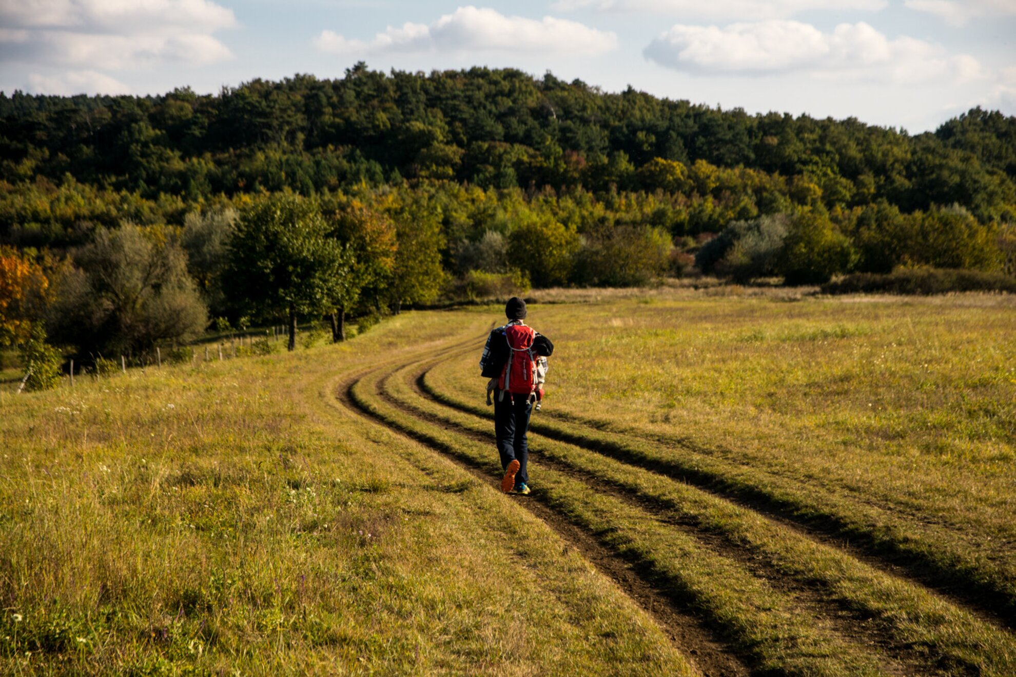
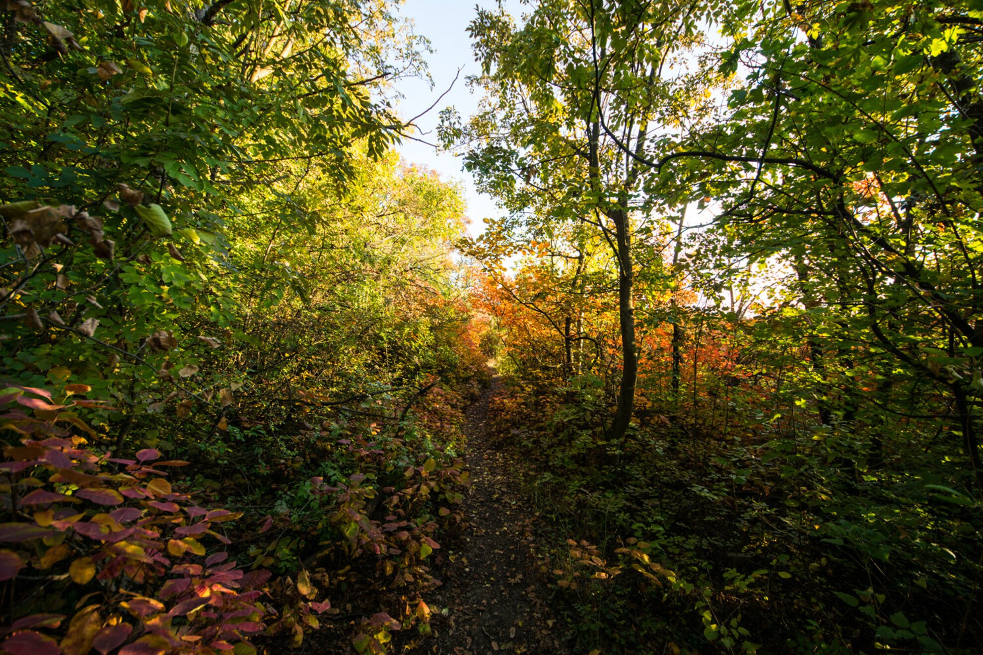
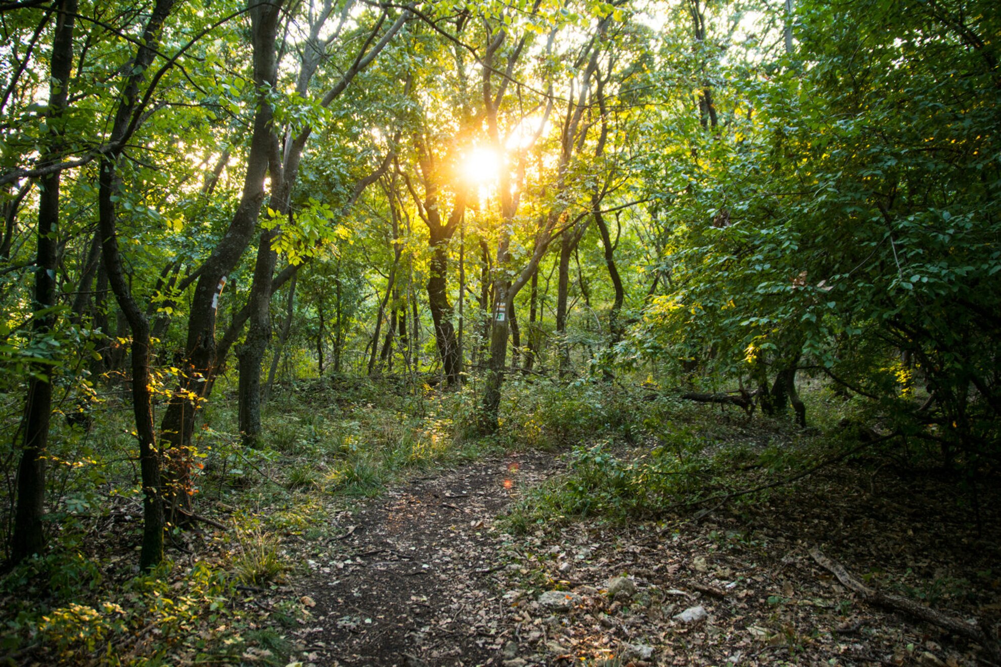
Just to make it easier for the imagination: we climb to the summit through forest paths similar to this one.

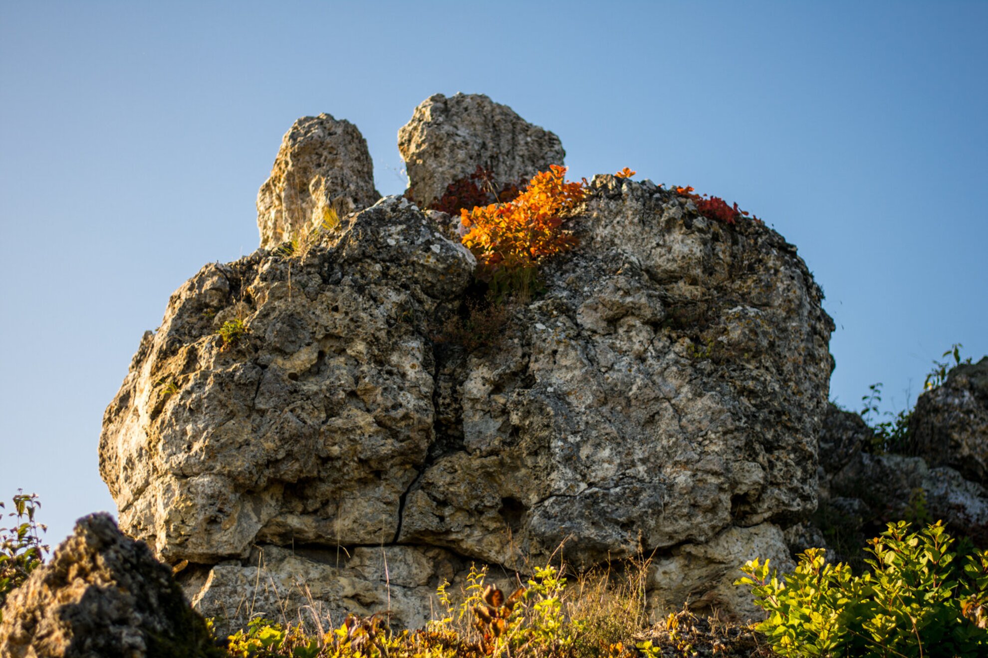
Aranyház (meaning "Golden House") geyser cone towers in front of us upon stepping out of the woods; it was named after the yellow lichen covering its rocks.
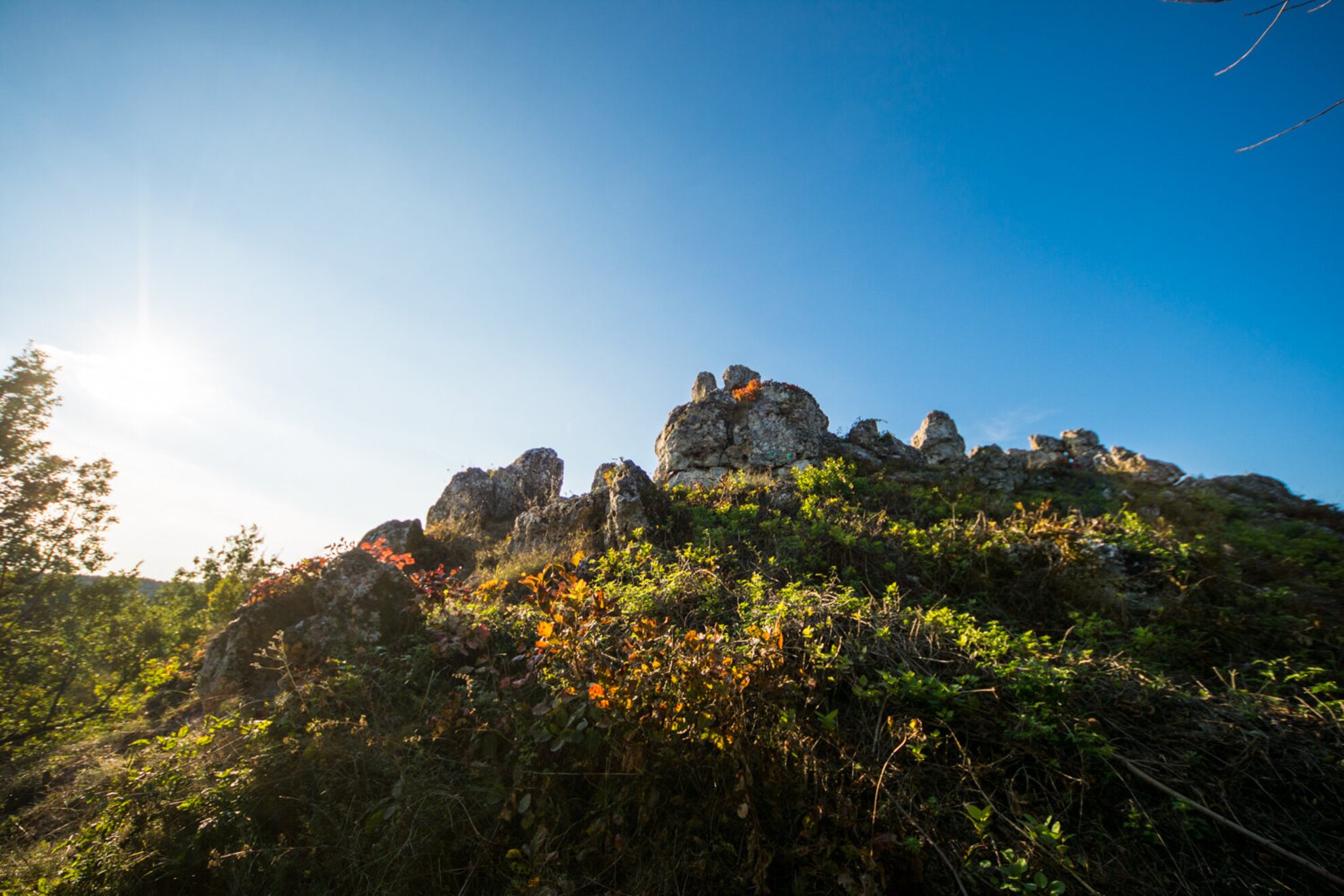
The cones that were believed to be geysers are the unique geological formations of the peninsula. The information board tells us that these weren’t actually hot springs, but thermal springs that surfaced in groups or by themselves along the fault lines millions of years ago. When the water was ejected, it cooled down suddenly, and the minerals in the water, like slaked lime, continuously enlarged the cones.
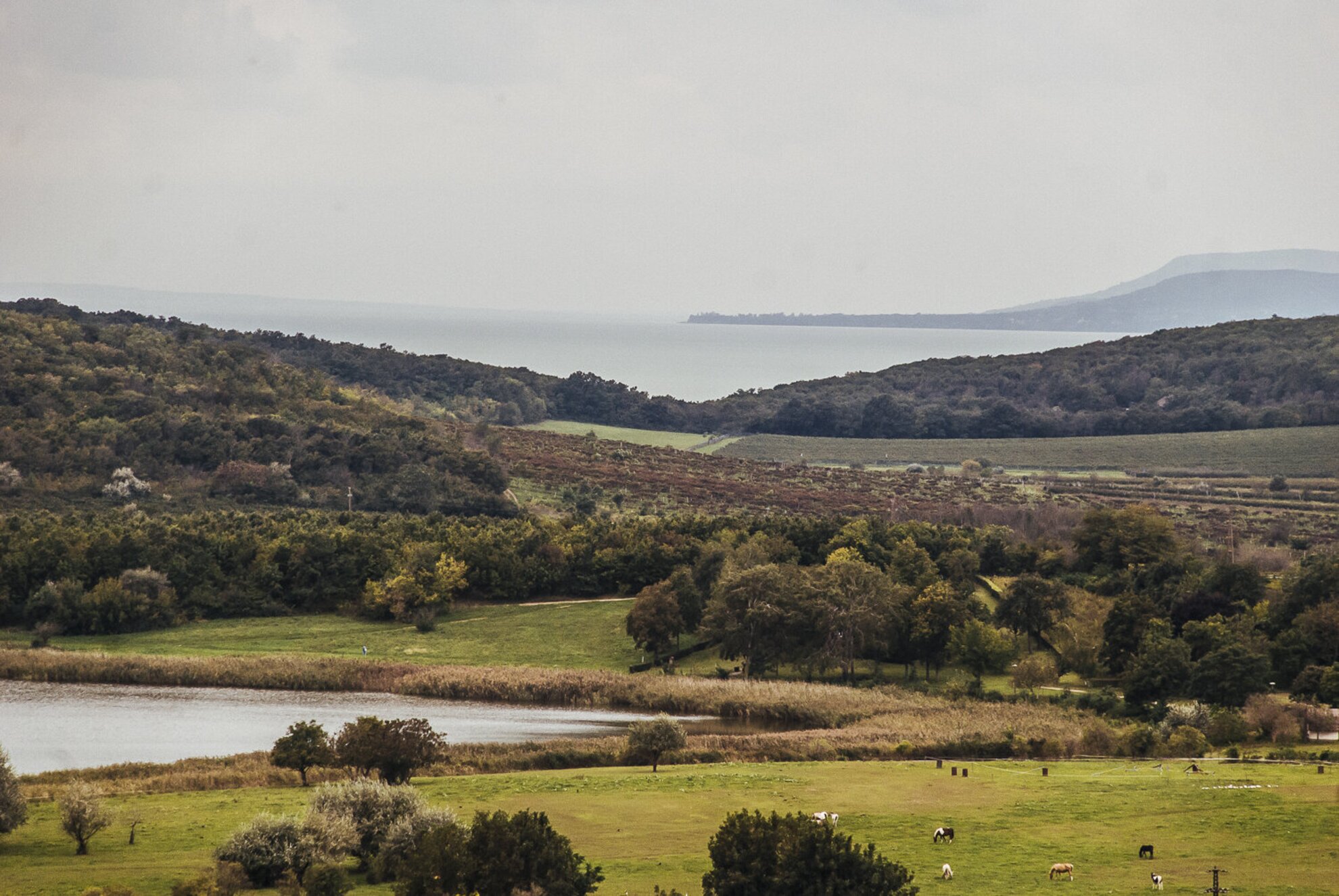
Besides the history class turning into geography up here, the view is also something to talk to, as from here we can not only see the whole peninsula, but, just above the foliage, there’s the blue of Lake Balaton.
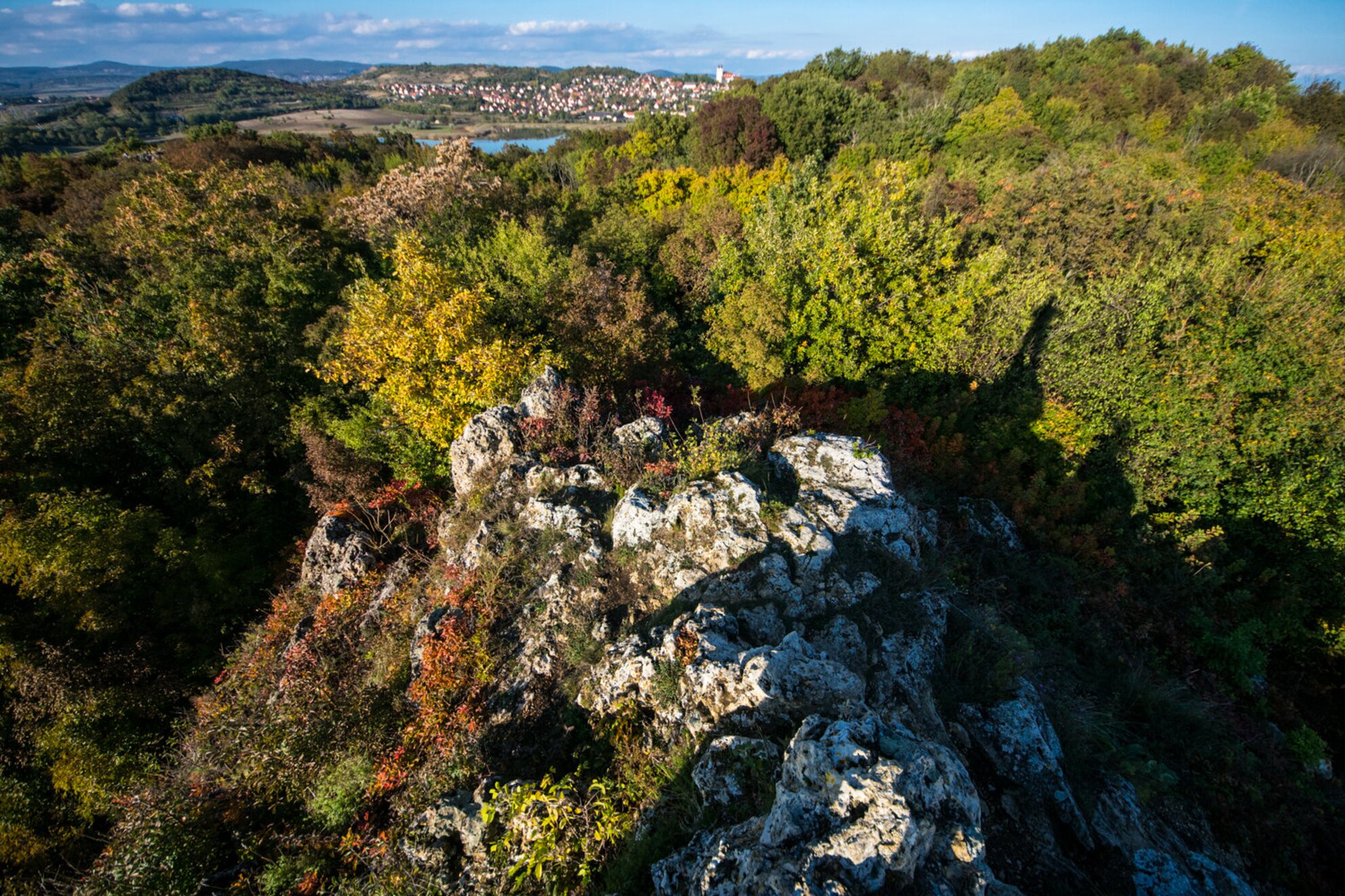
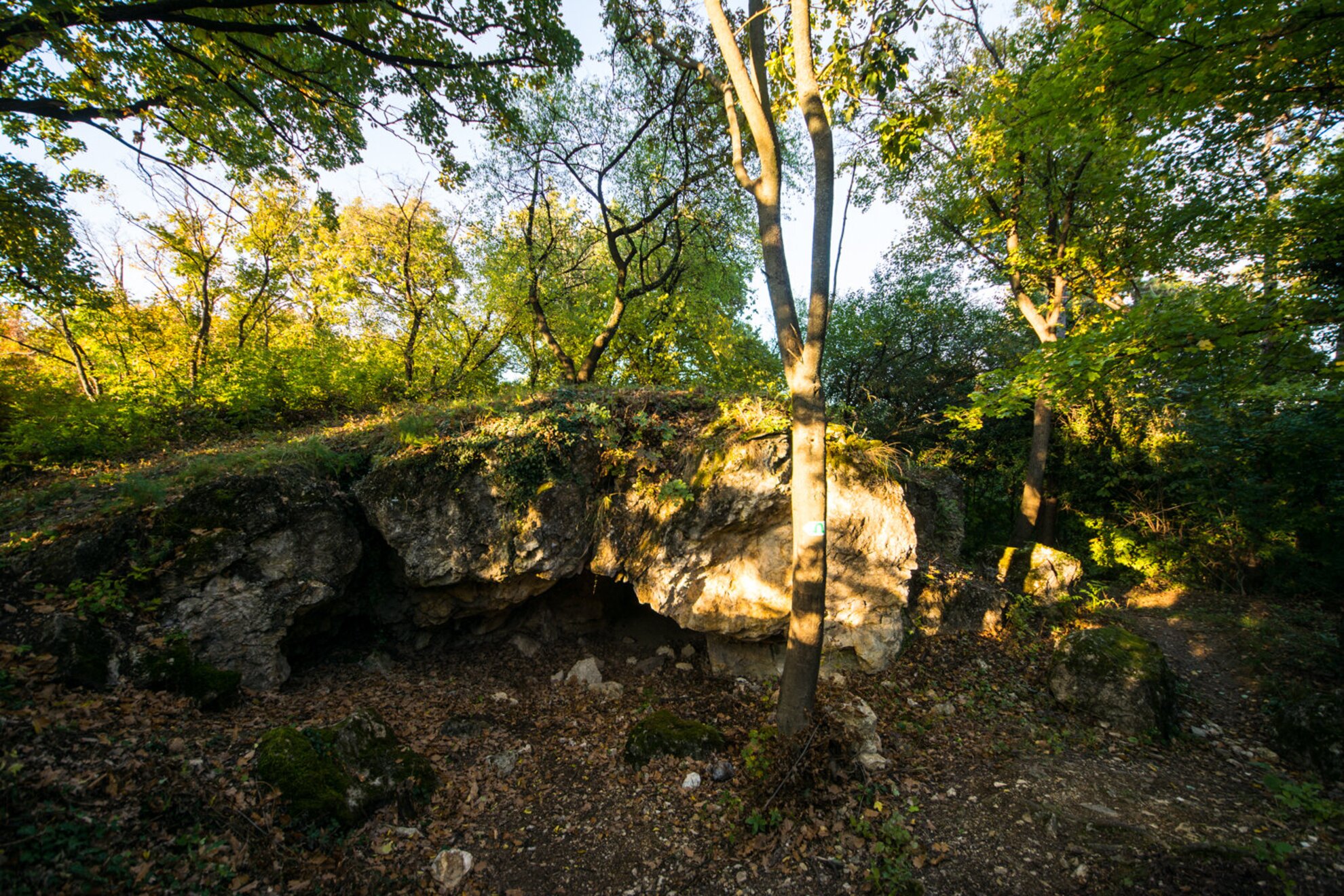
The quick geography lesson continues on Lóczy Study Trail (green “T” sign). It’s easy to walk past Átjáró Cave, even though it's one of the most complex spring cones. The study trail has a section in the cave showcasing rocks protected by bars.
From here, we keep walking on the study trail and follow the yellow cross sign towards the Geyser Field. The area between Lake Belső and Szarkádi Forest has the most hot spring cones, the largest portion of the more than a hundred rock formations are located here, and this is why it’s called the geyser field. After the area’s volcanoes cooled off few million years ago, the heat from the molten rock (magma) that got stuck in the deep kept the area warm for thousands of years.
High-temperature gases originating from the molten basalt flew upwards in the cracks, and they got mixed with groundwater, they got absorbed by it. The hot water became aggressive and it released lime, flint, dolomite, and iron from the sedimentary rocks, and then encrusted them on the surface to shape cones. This resulted in the formation of geyserite, a rock varied in structure.
We bump into numerous interesting geyser cones here, like Borzvár (meaning “Badger Castle”).

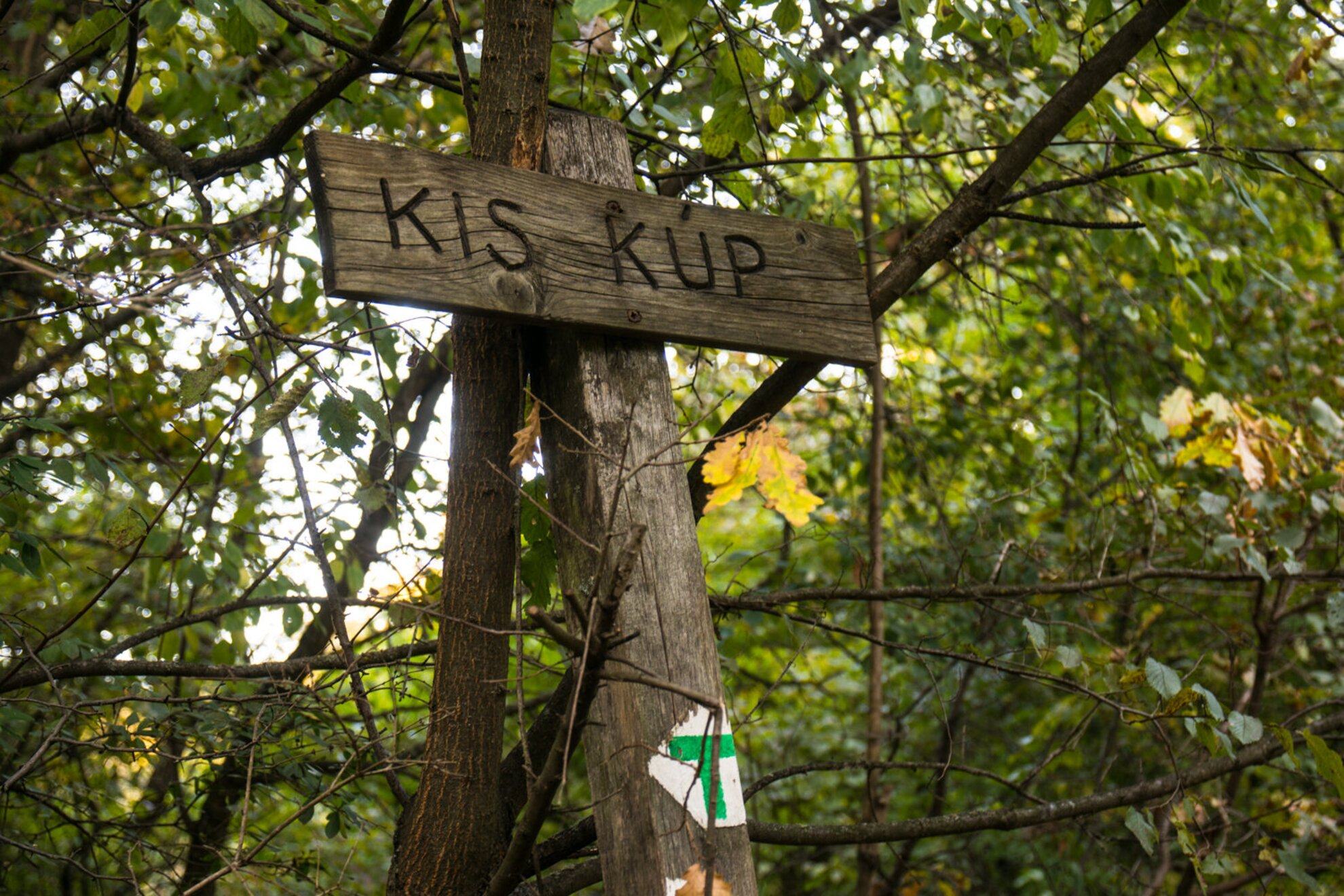
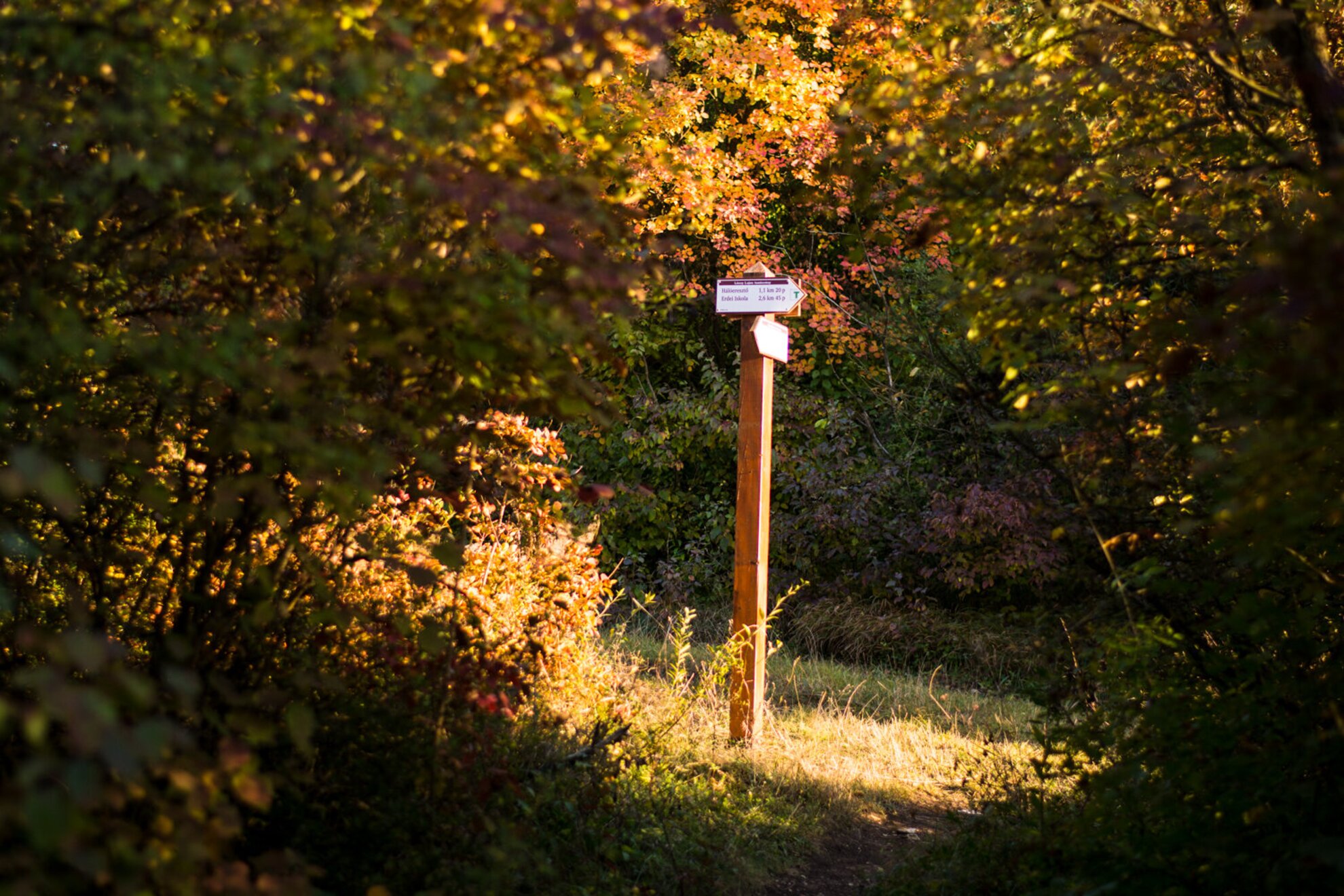
We follow the green sign from Borzvár towards Hálóereszkedő, from where we’ll follow the yellow strip towards Csúcs Hill.
Our road leads through Szarkadi forest, among oaks, ash, and maples. Make sure to watch your step, because you might bump into the protected great capricorn beetle or stag beetles, while on the sides of the mossy tree trunks you might spot smooth newts or garlic toads.
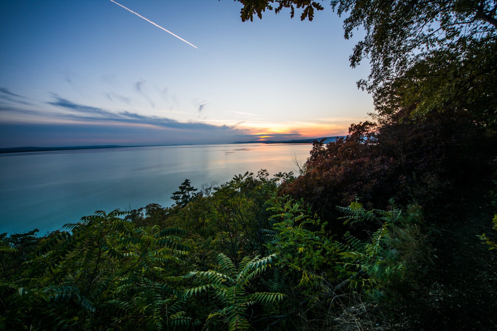
While we walked on the narrow forest road, we didn’t even realize how close we were to Lake Balaton, until we found a spot from where it felt like we were looking at a huge body of water from a clearing in a jungle.
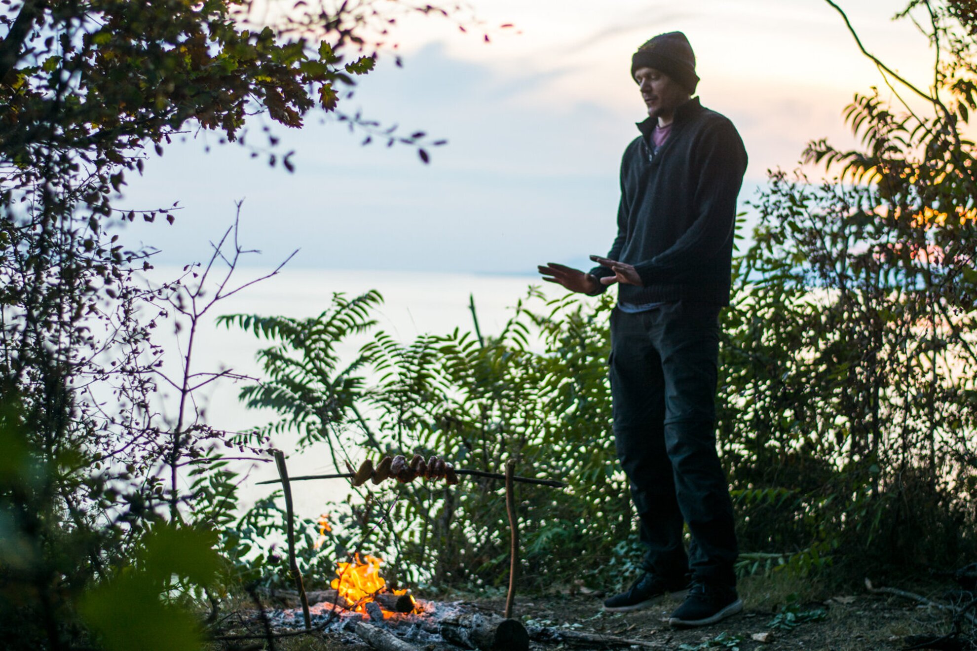
Here, in the middle of nowhere at Tihany, something very unexpected happened: we bumped into Jono, a guy from York listening to rockabilly and barbecuing a chicken wing on a stick for dinner. As it turned out, Jono was not only there to hike, but he also planned to spend the night in the forest. He said he wasn’t afraid of the wildlife, only the possibility of some crazy people showing up.
As much as we wanted to stay and have dinner with him, we went back to our starting point as it got dark very quickly, even though we didn’t manage to conquer Csúcs, Nyerges, and Apáti Hills on the road that gets around the Old Lavender Field. Those who are after the view might want to go that way, following the yellow strip. Then, from Apáti Hill, you have to follow the yellow triangle back towards Kőfejtő, from where the green triangle leads back to Lake Belső, the first stop of our tour.